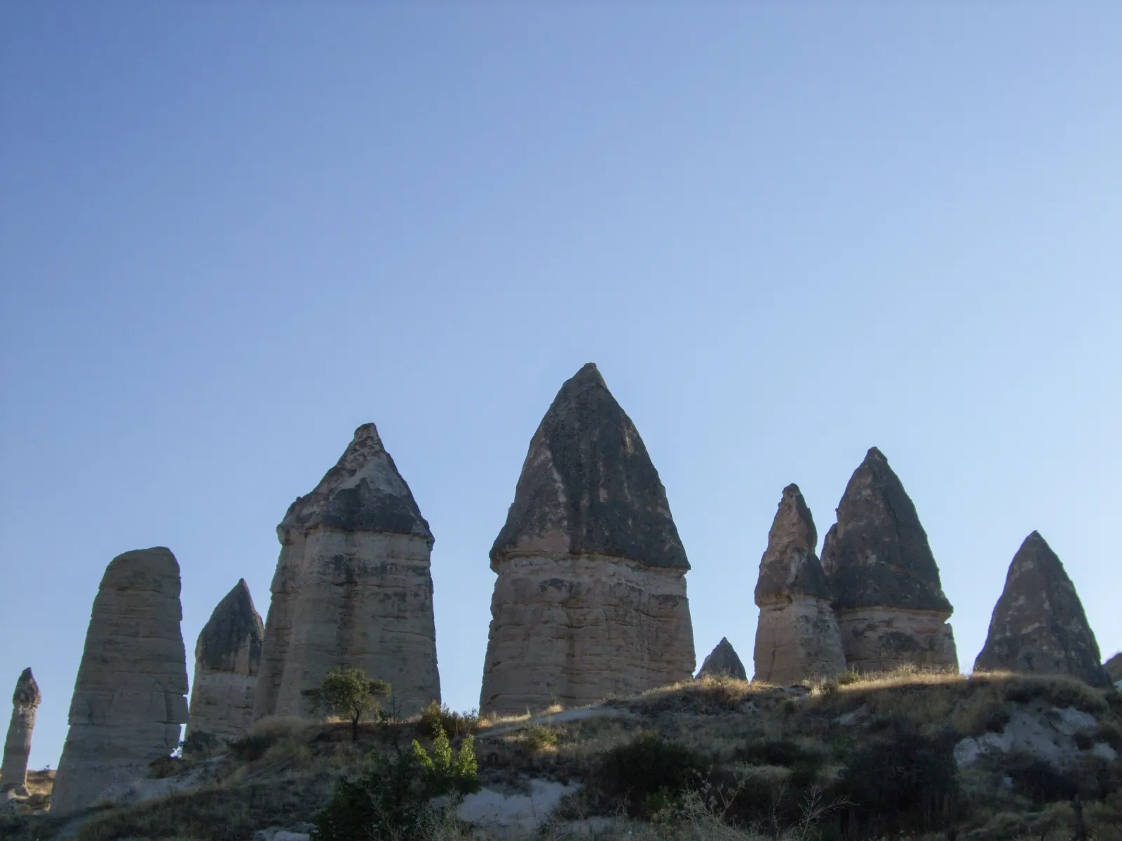
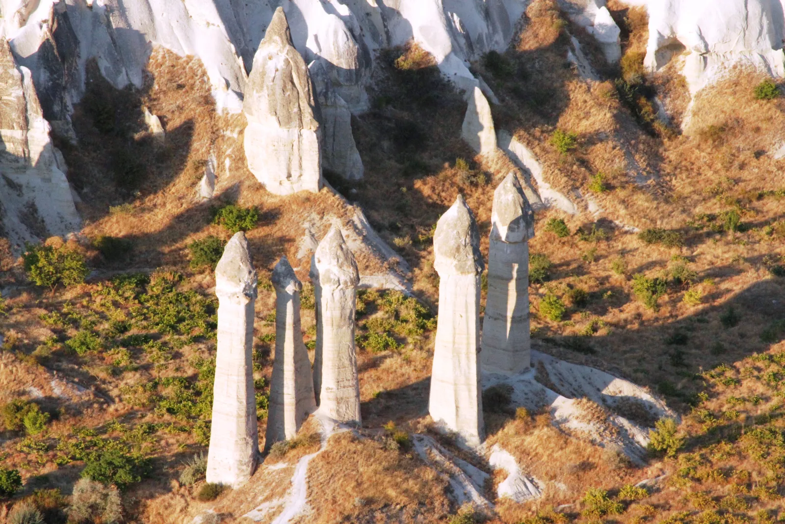
Love Valley — Aşk Vadisi — runs north from Göreme toward Uchisar, and its name comes from the shapes of its fairy chimneys. The formations here are tall, smooth, and distinctly columnar — some reaching 25 to 30 meters — with rounded tops and few of the dark basalt caps that characterize formations elsewhere in Cappadocia. The columns are pale cream to pinkish in color, tapered toward the top, and standing in dense clusters along the valley floor. Their shape is unmistakable, their name is deliberate, and the valley is one of the more photographed landscapes in the region.
The geology that produced these forms is a variation on the standard Cappadocian erosion process. In Love Valley, the tuff layers are relatively uniform in hardness — there is less contrast between cap rock and column rock — which produces smoother, more gradually tapered forms rather than the sharp cap-and-stem mushroom shapes seen at Paşabağ or the Three Beauties. The result is a forest of columns rather than a field of mushrooms, and the visual effect at ground level — walking between formations that tower overhead — is distinct from any other valley in the region. If you have already visited the Göreme Open Air Museum, this is the geological counterpart — churches carved into rock versus rock left to its own devices.
Walking the Valley
The valley trail starts from the Göreme side (accessible from the road that runs toward Uchisar) and follows the valley floor northwest for approximately two to three kilometers. The trail passes through the densest concentration of columnar formations in the first kilometer, where the chimneys cluster on both sides of the path and the valley narrows to create an enclosed, almost corridor-like experience.
The terrain is gentle — mostly flat to slightly undulating, with a gravel and earth surface. This is one of the easier valley walks in Cappadocia, accessible to visitors of most fitness levels. The trail is well-worn but not formally maintained — there are no railings, interpretive signs, or facilities along the route. Bring water. When I walk travelers through here, I suggest keeping to the valley floor for the first kilometer — the formations are at their tallest and most densely packed, and the sense of scale is something you feel rather than photograph.
Beyond the main formation field, the valley opens and the chimneys thin out. Some hikers continue to the Uchisar end and return by road or trail; most turn back after the main formation area, making the round trip approximately four to five kilometers and an hour and a half to two hours.
The View from Above
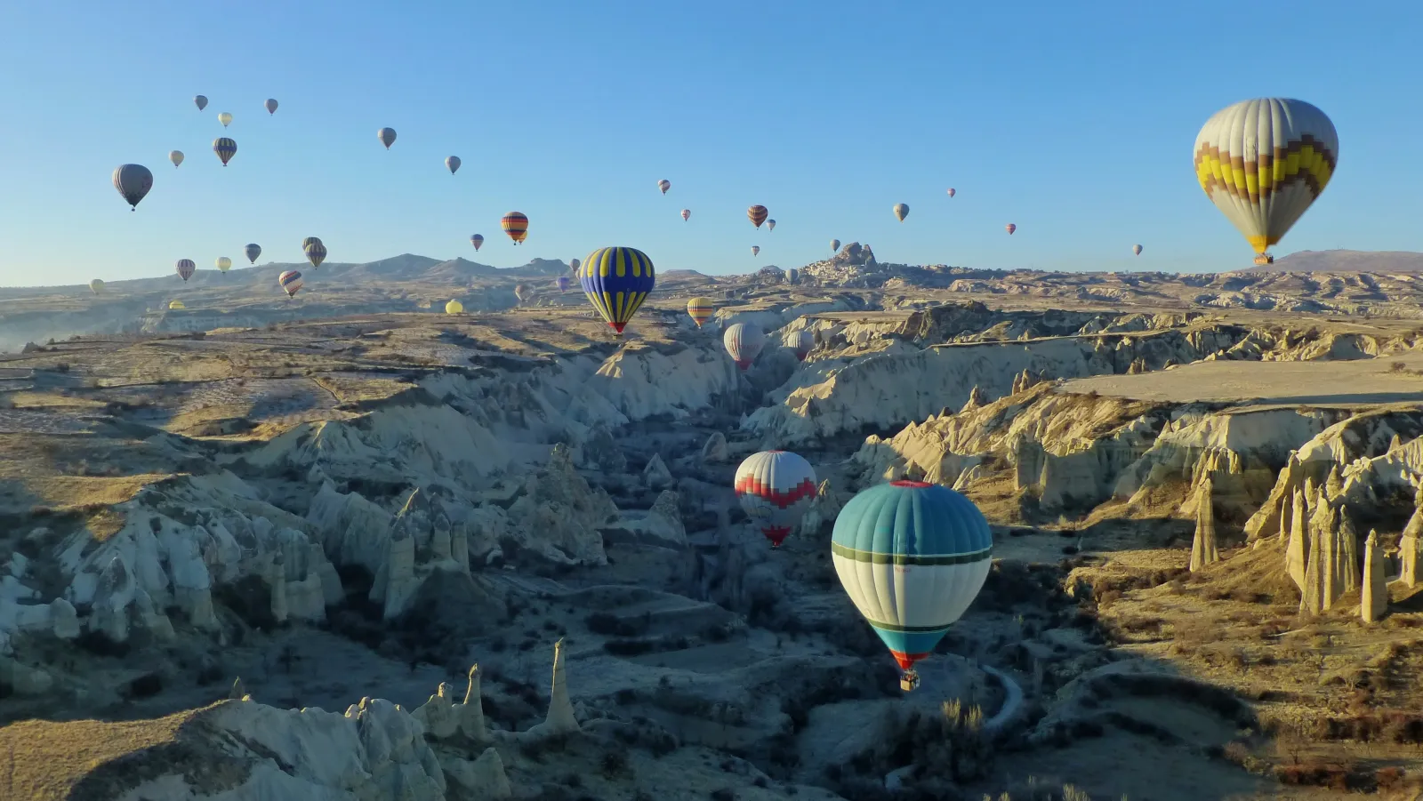
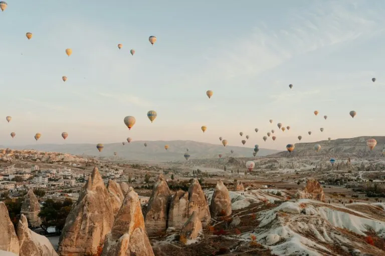
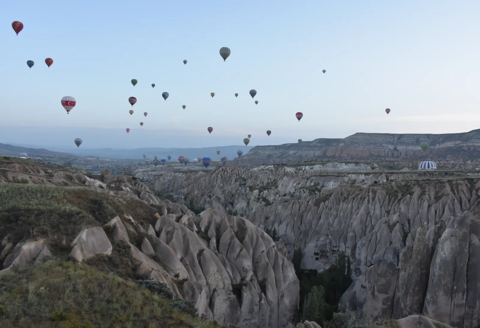
Love Valley is one of the valleys most visible during a hot air balloon flight — the columnar formations are distinctive from the air, and the low morning light casts long shadows between the columns that accentuate their height and density. If you fly the balloon before walking the valley, you will recognize the landscape from above; if you walk first, you will recognize it from the basket. When I plan a Cappadocia day, I often schedule the balloon at dawn and the valley hike mid-morning — you see the same landscape from two altitudes on the same day.
The valley is also visible from several ridge points near Göreme and from the slopes below Uchisar Castle. The Göreme Panoramic Viewpoint, a common sunset spot, overlooks the valley entrance. The underground cities at Kaymaklı show what Cappadocians did below the surface; Love Valley shows what nature did above it.
Practical Information
Getting there: The main trailhead is accessible from the Göreme-Uchisar road, a short drive or fifteen-minute walk from Göreme center. There is informal parking near the trailhead. No dolmuş service reaches the trailhead directly.
Trail length: Approximately two to three kilometers one way through the main formation area. The round trip takes one and a half to two hours at a comfortable pace.
Difficulty: Easy to moderate. Mostly flat terrain, uneven surface. No technical sections. Suitable for visitors of most fitness levels.
When to go: Early morning gives the best light — the east-facing valley catches the first sun, and the long shadows between the columns create dramatic depth. Late afternoon is also good. The valley is popular at sunrise with photographers and balloon-chasers.
Official resource: Göreme Historical National Park — UNESCO
Combining with other visits: Love Valley pairs with the Göreme Panoramic Viewpoint (overlooks the valley entrance), a balloon flight (the valley is visible from the air), or a continuation to Uchisar Castle via the ridge trails. It also works as part of a two-day Cappadocia itinerary.
Plan Your Cappadocia Visit
Love Valley is the walk that puts you inside Cappadocia’s geology — between the columns, beneath the forms, at the scale where the landscape becomes physical. If you would like to hike the valleys with a private guide who knows the trails and the light, tell us what interests you and we will shape the day around it.